Fine and cool to warm for most of SA, but cloudy conditions expected in some parts. (Peeradon Warithkorasuth/Getty Images)
Fine and cool to warm temperatures are forecast for most of the country, but cloudy conditions are expected in some areas, according to the South African Weather Service.
Impact-based warnings
An Orange Level 6 warning for damaging winds and waves, resulting in danger to navigation at sea, is expected between Cape Agulhas and Port Edward.
An Orange Level 6 warning for damaging interior winds, resulting in damage to settlements (formal and informal), temporary structures, difficult driving conditions and injuries and danger to life from flying debris, is expected along the coast between Plettenberg Bay and Port Alfred.
A Yellow Level 2 warning for damaging winds, resulting in localised damage to settlements and temporary structures as well as difficult driving conditions, is expected over the eastern and central parts of the Eastern Cape and along the coast in the eastern parts of the province.
A Yellow Level 3 warning for damaging waves, leading to disruption of small harbours and ports, between Cape Agulhas and Saldanha Bay, spreading to Alexander Bay by the evening, continuing through to Thursday morning.
Fire danger warnings
Extremely high fire danger conditions are expected over the Vhembe, Mopani and parts of Sekhukhune districts in Limpopo, as well as in places over the interior of the Eastern Cape.
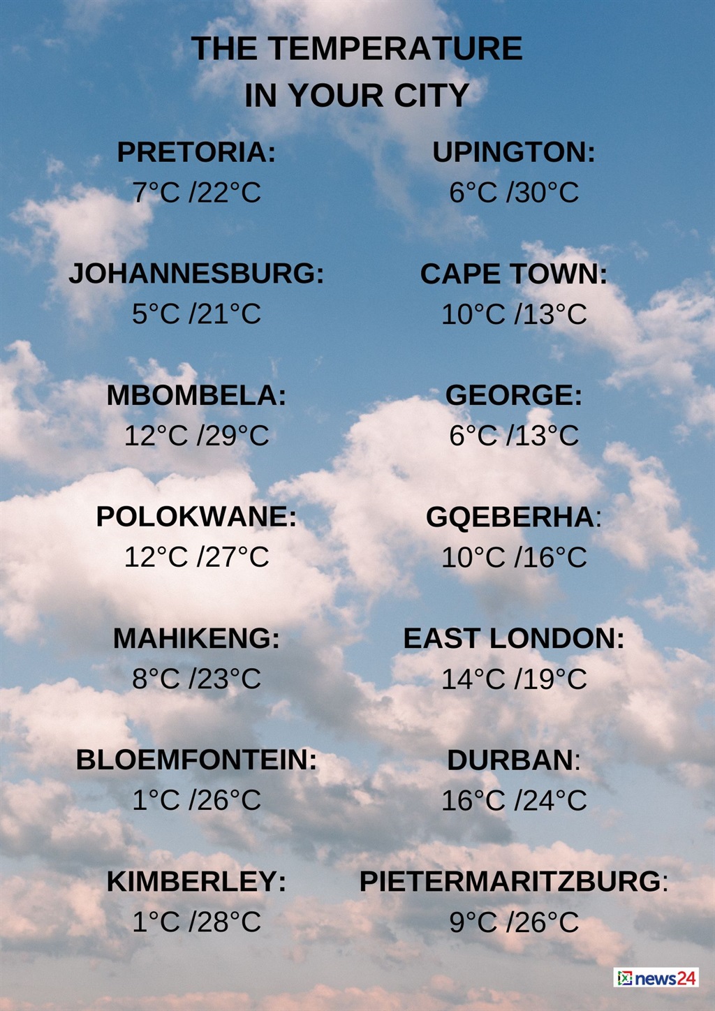
The weather in your region
Fine and cool temperatures are expected in Gauteng, but it will be warm in the north.
The expected UVB sunburn index is very high.
Mpumalanga will be fine and warm, but cool over the south-western areas.
Fine and warm conditions are forecast in Limpopo, with morning fog patches in the west.
The North West can expect fine and cool to warm temperatures.
Fine, windy and cold to cool conditions are forecast in the Free State and the Northern Cape.
The wind along the coast will be a moderate to fresh north-westerly.
The Western Cape can expect cold temperatures and cloudy to partly cloudy conditions, with isolated showers and rain in the morning.
It will become fine in places over the north-eastern parts from the afternoon.
The wind along the coast will be a moderate to fresh southerly to south-westerly, but strong to gale along the south coast until late afternoon.
The expected UVB sunburn index is low.
Cloudy conditions are forecast in places over the western half of the Eastern Cape, with isolated showers along the coast and adjacent interior.
The wind along the coast will be a strong to gale force south-westerly, moderating at night.
The eastern half of the province will be cloudy in places in the west in the morning, otherwise fine and cool conditions are forecast.
The wind along the coast will be a strong to gale south-westerly.
KwaZulu-Natal can expect partly cloudy conditions in the north-east, otherwise it will be fine and warm.
The wind along the coast will be a moderate north-westerly north of Richards Bay at first, otherwise a fresh to strong southerly to south-westerly is expected.
The expected UVB sunburn index is extreme.
news24
www.news24.com
